Swargarohini
The Sacred Way To Heaven
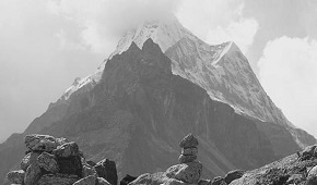
Swargarohini
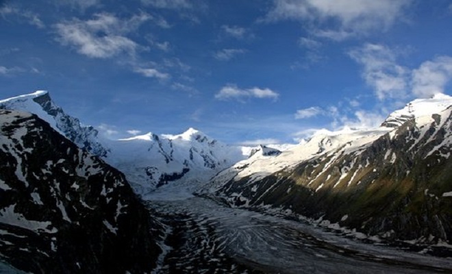
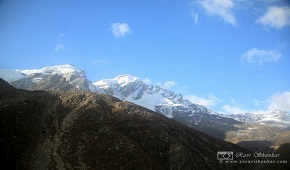
Swargarohini is a mountain massif in the Saraswati (Bandarpunch) Range of the Garhwal Himalaya. It lies in the Uttarkashi District of the northern Indian state of Uttarakhand, west of the Gangotri group of peaks. It comprises four separate peaks; Swargarohini I is the main peak. While not particularly high by Himalayan standards, and not the highest in the Bandarpunch range, Swargarohini I is notable for its dramatic local relief. For example, its north face drops 2,000 metres (6,560 ft) in less than 2 kilometres (1.2 mi) of horizontal distance, and its south face achieves the same drop in less than 3 kilometres (1.9 mi). This makes it a steep and challenging climb. Swargarohini I has two summits, east and west. The east summit is given an elevation of 6,247 m (20,495 ft), slightly lower than the west summit. However the first ascensionists of the west summit claim that that summit is the higher of the two.
This snow-clad peak along is the source of the Tons River and along with the Bandarpunch massif it acts as a divider between the Yamuna and the Bhagirathi Rivers.
Swargarohini Trek
Brief Itinerary
Region :- Uttarakhand
Duration :- 05 Days
Grade :- Moderate to Difficult
Max Altitude :- 14,436 Ft.
Day 1: Mana to Lakshmi Van
Day 2: Lakshmi Van to Chakrateerath
Day 3: Chakrateerath to Satopanth Taal
Day 4: Satopanth lake to Lakshmi Van
Day 5: Lakshmi Van to Badrinath
Detailed Itinerary
Day 1: Mana to Lakshmi Van
We’ll start the trek from Mana, go on the other side of Bhimpul and beyond. Bhimpul derives its name from the legend
that Bhim put rocks across the Sarasvati River for Draupadi to cross it. After crossing the pul, we’ll trek for another 5kms to reach
the magnificent Vasudhara falls. After a short halt, we’ll continue for another couple of kms to reach the Lakshmi Van where we’ll set
up our campsite for the night.
Mana Village - 3 km from Badrinath, this is the last village of India on the Indo-Tibetan border. The Indo-Mongolian tribe set up this
village. A population of 200 people lives here. As soon as the gates of Badrinath open, they come here and as soon as they close, they
go down to the plains where they live for the rest of the year. In this way they live a dual family life. These people are very
hardworking and industrious. They wherein the women knit and weave sweaters, carpets, etc run a small-scale industry of woolen clothes.
Bheem Pul - Bridge - A short distance from Mana Village a natural bridge made of a huge boulder, over the river Saraswathi is seen. The
story goes that Bheem; one of the Pandava brothers put it there. The view of this extraordinary bridge and the din of the flowing river
make this place interesting. Vasudhara falls - 5 km after Bheem Bridge this astonishingly high waterfall is very attractive. The most
interesting aspect about this place is that all the water here becomes vapour and vanishes into the atmosphere. The view looks like the
Ganges is descending from the sky.
Day 2: Lakshmi Van to Chakrateerath
From Lakshmivan we trek across the Sahastra Dhara to reach Chakrateerath. Today we’ll trek for about 10Kms.
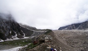
Day 3: Chakrateerath to Satopanth Taal
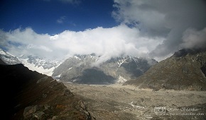
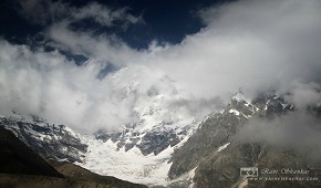
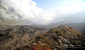
Today’s trek is not for the faint hearted. High altitude, cold mountain winds, and unpredictable weather conditions make it extremely exciting and dangerous. A 3 km glacier walk will bring us to the Satopanth Taal, where we’ll set up our camp for the night.
Day 4: Satopanth lake to Lakshmi Van
Further up is Swargarohini – the gate of heaven. We pay our respect to the gods at Swargarohini and come back to our campsite at Satopanth.
Day 5: Lakshmi Van to Badrinath
We trek all the way back to Mana village. Trip ends at Mana village.
From Mana, Badrinath is 3kms away and if you prefer, you can get accommodation at Badrinath or head to Joshimath and stay for the night.